The 1812 Santa Barbara Earthquake: In Brief
 In 1812, Mission La Purisima, situated
in the bucolic setting of Lompoc Valley, was typical of the nineteen Spanish
missions that were spread throughout California. But on the morning of
December 21, around 10:00 or 10:15, the quiet of that mission was upset
when the earth underneath Mission La Purisima began to shake. The strong
earthquake frightened the mission's residents-- padres, Indians, and soldiers--who
rushed out of the mission buildings. Luckily for the mission residents,
they were too scared to reenter the buildings, because the first shock
turned out to be only a foreshock.
In 1812, Mission La Purisima, situated
in the bucolic setting of Lompoc Valley, was typical of the nineteen Spanish
missions that were spread throughout California. But on the morning of
December 21, around 10:00 or 10:15, the quiet of that mission was upset
when the earth underneath Mission La Purisima began to shake. The strong
earthquake frightened the mission's residents-- padres, Indians, and soldiers--who
rushed out of the mission buildings. Luckily for the mission residents,
they were too scared to reenter the buildings, because the first shock
turned out to be only a foreshock.
About fifteen minutes later, a stronger earthquake struck. The shaking was so intense that the mission's church bells rang out, the adobe walls of the mission buildings were shattered, were thrown out of plumb, and in some instances collapsed, reducing Mission La Purisima to "rubble and ruin, presenting the picture of a destroyed Jerusalem." Severe damage from the earthquake was also reported from Mission Santa Ines, Mission Santa Barbara, the Santa Barbara Presidio, Mission San Buenaventura (Ventura), and Mission San Fernando, covering a distance of over 100 miles.
The soldiers at the presidio in Santa Barbara were so disturbed by the earthquake that they abandoned the presidio, building thatched huts near the Santa Barbara Mission, where the shaking from the earthquakes was said to be more moderate. Strong earthquakes continued to rock the region through February of 1813. The Spanish soldiers from the presidio did not return to their former home until March, almost three months after the first earthquake.
There is also a report of a tsunami at Refugio Canyon near the northwestern end of the Santa Barbara Channel and abandonment of Chumash villages on Santa Rosa Island. Not everyone is convinced that a tsunami occurred which could have produced the effects that many people ascribe to it.
The missionaries reported that a large ground crack opened in the hill behind (south) of the mission, and that three days later the mission site was flooded over by mud that washed out from the crack.
Photographs
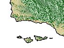
Map--enlarged version of above (42 kb)
Ruins of Mission La Purisima in 1935 and 1970

![[Top]](../images/top.2.gif)
![[1812]](../images/1812.2.gif)
![[1857]](../images/1857.2.gif)
![[1902]](../images/1902.2.gif)
![[1925]](../images/1925.2.gif)
![[1927]](../images/1927.2.gif)
![[1978]](../images/1978.2.gif)